It seems like another satellite or off-network communicator debuts on Indiegogo or Kickstarter every month but trust us: if you break an ankle in the woods, you’ll want to get help ASAP, and you probably don’t want to rely on a startup’s potentially iffy tech. We didn’t break any limbs while testing the following devices, but we did go off the grid with a backpack full of electronics to see what works, how complicated these brightly colored beacons are — this would matter if you couldn’t walk — and which is best for different uses.
Spoiler alert: no dinky startup gizmos made the cut. But, a few companies that were formerly in start-up mode have broken through with great product, and you will find those devices, from the likes of Beartooth and GoTenna as well as Somewear and Bivystick, in our reviews below.
Of course what you care about is which widget might save your carcass in the wild, or which is just a handy tool for communication sans cell reception. To answer that, we have to kick a question back to you: what do you want this thing for? Do you need one at all?
Should You Buy a Satellite Messenger Device?
To help you boil down your answer, consider how far from civilization you’re planning to trek and for how long. And, directly linked to that question: how much money do you want to spend?
If you’re going climbing in a faraway place like the Himalayas, the answer is simple: spend more to have a device that’ll reliably fire out an SOS, no matter what. Then again, if you’re dirtbagging your way to Kathmandu and never intend to stray too far from humankind, then all you need is a tool to help you scrimp on cell charges — maybe a foreign SIM is all you need. Then again, that math changes, too, depending on if your goal is to stay in digital touch with a friend who’s also traveling with you, or someone (or multiple someones) back home.
Types of Satellite Messengers
Think of the devices in this buying guide as falling into three distinct camps.
The first camp is the extreme one, satellite communicators that don’t need a smartphone to work. The big names here are Spot and Garmin. With both Spot and Garmin you can send and receive messages, but they do require subscription services that can get expensive. All three that we tested don’t need to tether to a cell phone to send messages, and that can be important if keeping a cell phone charged is yet another hassle you don’t want to sweat. We’ll dig into the weeds of these individual devices and their pros and cons, but the three we tested are mostly ideal for when you’re going somewhere genuinely remote.
The second camp is very much like the first, except cell phones are required. These are satellite beacons from Somewear and Bivystick. Unlike the Spot and Garmin devices, these do require pairing with a phone. They either have exceedingly limited messaging input of their own, or none at all; like the wire coming into your house on a landline phone. Input is all on your cell phone — these devices just provide the connection.
Lastly, GoTenna and Beartooth also pair with your phone, but they don’t talk to satellites at all. Instead, they have far more in common with old-school walkie-talkies. They’re essentially two-way radio signalers that send messages back and forth on their own networks. (In reality, they’re more complicated than that, and we’ll explain how — and why you need to care, below.)
Terms to Know
Networks: There are two main satellite networks that North American users should be aware of: Globalstar and Iridium. The latter is the closest network to being truly global. That doesn’t mean it will work everywhere, but it’s the better bet if you plan on going to the extreme ends of either pole or parts of central Asia and Africa — or northern Alaska, for that matter.
Mesh: You know how your home or office Wi-Fi network has a limited range, but you can add a repeater to extend that reach? That’s a mesh network. The more repeaters you add, the farther you can extend that network, and it can piggyback on existing cell towers to extend the range further. Imagine that a daisy-chain of these repeaters were all dispersed around a mountain, extending cell service from a tower into the backcountry; that’s how mesh works.
Tracking: Most of these devices allow you to send an automated updated GPS waypoint to another device or email address. Whoever is on the receiving end — friend, family, loved one — can know precisely where in the world you are by clicking a link to a map that displays your actual geographical location. That might be important if you’re about to enter a crux pitch of a climb, bomb a Class IV rapid, or begin a multi-day fat bike trip in southern Utah. You can send tracking updates at the push of a button or set the device to leave them at pre-specified time intervals like a virtual breadcrumb trail.
Offline Maps: For the most part these devices offer bread-crumbing of your travel on an offline map you download via an app on your phone. This is handy for not getting lost, though the clarity and granularity of detail are nowhere close to what you’ll find from a quality paper 7.5-minute topographic map, some standalone GPS units, or apps like Viewranger. Unless you’re navigating through a featureless desertscape, the offline maps do provide enough major geographic features to aid basic navigation but don’t expect to figure out precisely which sport route is the 5.10 by them.
Who’s Texting Me?: This isn’t a term, but it’s important to know that every one of these devices, even the ones that do pair to your phone, send out messages from another ten-digit phone number, rather than using the number of your own cell phone. The person you want to send help — or just say hi to — has to know that number! It’s pretty basic, but you’re going to want to establish an address book for the device before you depart.
Service Contract: You know this one. Yep, these devices frequently have activation fees, service contracts and the rest, just like major telcos. We’ll explain for each device, since how much you want to pay — how about nothing?! — may dictate which device you feel you truly need.
SOS Button: Some of these devices have a dedicated button for sending an SOS to authorities with your coordinates. It’s a life-or-death tool — devices that lack that output simply aren’t emergency beacons, because they cannot alert people or authorities that you’re in trouble without being tethered. Again, consider why you are making this purchase — if it’s for just-in-case-it-all-goes-pear-shaped emergencies, you want that SOS button, full stop.
The Best Sattelite Messengers Available
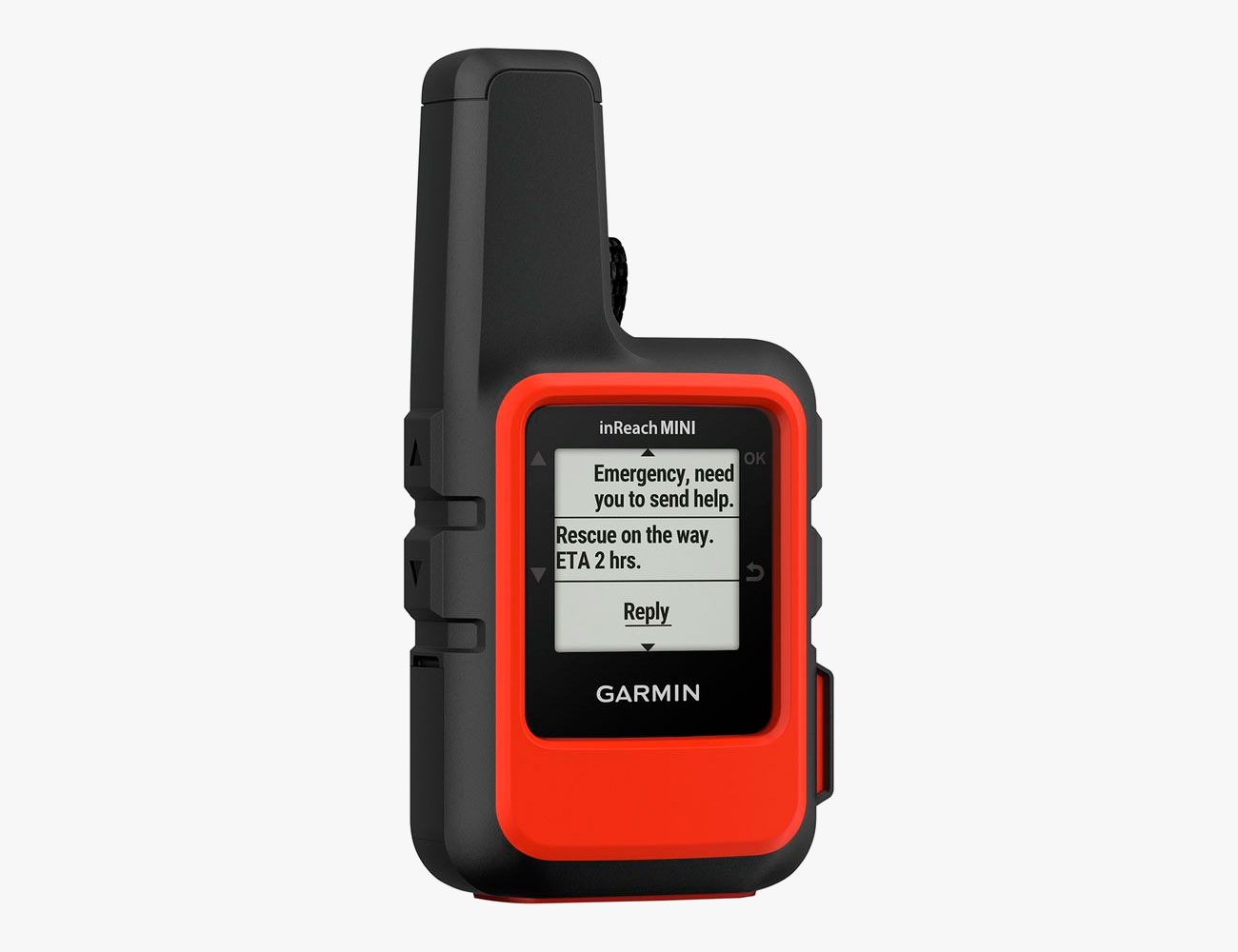
Editor’s Choice: Garmin InReach Mini

Best for: Going fast and light.
Learning Curve: 4/10
The Mini wins on one obvious level: it’s tiny. Compared to the Somewear and Bivystick it’s as little as half the size, and it’s positively Lilliputian compared to its big brother, the Explorer+. Note, however, that we did find that meant weaker reception under dense foliage, so we’d factor in connectivity and likely trip use case before going with the Mini. In the Rockies? Likely you’d have zero issues. But testing in New York’s Catskills, even before deciduous forests had fully leafed out, at times, it took a good five minutes to be able to tether and send/receive. The big brother Explorer+ powered up and locked in seconds, by contrast.
Like the Explorer+, the Mini uses the same ecosystem, but it lacks a color screen or mapping. While you can send and receive messages on the Mini, it lacks even a joystick/mouse input mechanism, so it’s far easier to choose the canned messages already baked into its interface. Luckily, as with the Explorer+, the menus are a snap to master, and there’s a big SOS button on the side that sits under a safety door to avoid accidental pressing.
The preferred way to send customized messages is via the Earthmate app, accessed from a phone that’s paired to the Mini. There you can also access offline maps (download before you depart), and this also enables tracking on your phone, as long as the Mini has satellites locked in. But on that front, we’d like an obvious way to know when satellite communication is reliable or shaky, although, as with the Explorer+, you do get an audible signal when a message went through.
Note that, as with other devices here, recipients will see messages as an SMS, but if you can get your contacts to register a Garmin inReach account, they’ll also see the messages in their e-mail inbox. Downsides? Battery life, for one, isn’t as robust as with the Spot X or Explorer+, and the same cost concerns enumerated on the Explorer+ review apply here since you have the same plan options to choose from.
Membership: Annual or monthly
Map Sharing: Yes
Weight: 3.5 ounces
Dimensions: 4 x 2 x 1 inches
Durability: Submersible in 1 meter of water up to 30 minutes
SOS Button: Yes
Battery Life: Rechargeable; in tethered/standby mode sending tracking at 10-minute intervals: 50 hours
Spot X
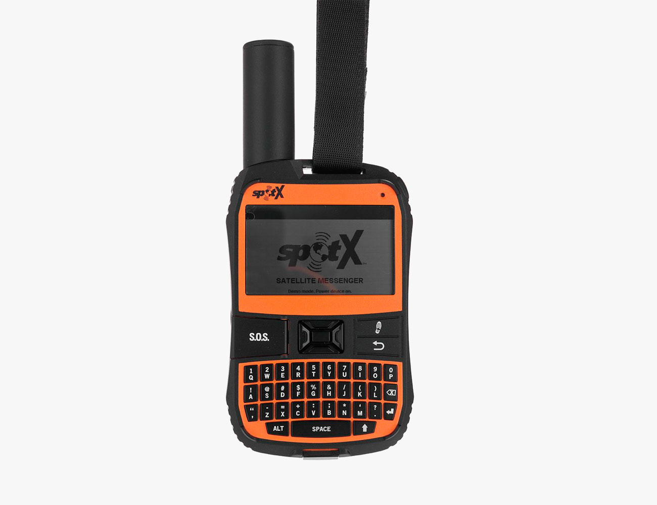
Best for: Mainland US Wilderness only.
Learning Curve: 7/10
The Spot X is the latest in a series of Spot communicators that use the Globalstar network. Ironically Globalstar doesn’t offer global coverage or even communication over the entirety of North America. That won’t matter for users in the lower 48, but do note that the bulk of Alaska isn’t fully covered.
Even if you’re only planning on using the Spot X in Montana or Mississippi, the weakest facet of the Spot X experience isn’t coverage; it’s usage. There’s no tethering via Bluetooth to a smartphone, the actual UI is confusing rather than logical, and all messages and other inputs are via a very weakly designed QWERTY keyboard. It’s worse than anything Blackberry ever produced, and the hard, oddly spaced keys make input exceedingly frustrating. You might even mull not calling for help just to avoid having to hunt and peck out a communique.
Further, inputting an address book requires creating an online account and then populating that address book manually, since there’s no way to sync this from a phone. Then you have to use the desktop Spot Device Uploader app while plugged into the Spot X.
While the Spot X pairs to satellites well, even under cloudy skies or surrounded by relatively thick forest, and can send messages to individuals via SMS (under its own dedicated phone number) as well as to social media, and lets you send an emergency SOS, it still feels outdated. In addition to lacking phone pairing, it doesn’t have its own native mapping, as others like the Garmin InReach Explorer+ do. That’s frustrating because if it cannot pair to a phone, then at least it would ideally function as a standalone GPS. It has a compass, but that’s not the same as a map identifying your location.
Is there still a good use case for the Spot X? Sure. If you’re an alpinist on a budget and want a standalone send/receive unit that’s relatively affordable, with lower carrying costs than the Garmins below, the Spot X is a logical pick (though the Garmin Mini is also worth considering). Its lowest price Flex Basic plan is $15/month with a one-month minimum and an annual fee of $25. For that, you get up to 20 custom messages (ones you compose yourself) and unlimited check-in/predefined messages. Breadcrumb style tracking is only at 10-minute intervals, where your location gets pinged to your in-group, but for $40 you can set up that interval to every 2.5 minutes — that’s far cheaper than the $100 Garmin wants to charge for an increased interval.
Membership: Annual or monthly
Map Sharing: Yes
Weight: 6.7 ounces
Dimensions: 6.5 x 2.9 x 0.9 inches
Durability: Submersible in 1 meter of water up to 30 minutes
SOS Button: Yes
Battery Life: Rechargeable; in tethered/standby mode sending tracking at 10-minute intervals: 240 hours
Garmin InReach Explorer+
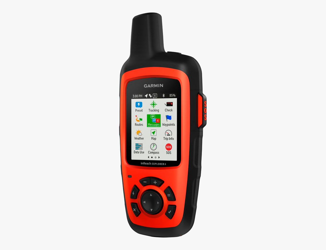
Best for: The back of beyond.
Learning Curve: 4/10
Both the Garmin Mini and this Explorer+ use the Iridium satellite network, which, as we explained above, has far more coverage than the Spot X’s Globalstar network. But there’s another reason to want the Explorer+ over the Spot X — phone app pairing, which the Spot X doesn’t offer. Download the free Earthmate app and input for texting and other tasks is blessedly simple on the Garmin. You can also post directly to social media (though see the below caveat on that). Recipients can even receive messages as both SMS and emails (if they create an InReach account), and that’s nice because a single message can come through to them on multiple channels, and therefore you can feel surer they’ll get the note. After a message has gone through a sound indicates that it was sent successfully. (Not every device here makes that quite as obvious.)
If your phone battery is dead, you can still output free, canned messages such as “I’m going to be late” using the mouselike pad of the Explorer+ unit, then picking the message you want via the full-color TFT screen on the handset. The fact that it displays color when every other unit with a screen only has hard-to-see monochrome makes a huge difference. And oddly, given the Spot X’s crude keyboard, we’d actually prefer to use the canned messages of the Garmin because navigation to them with over-large buttons and sending them takes all of five seconds and is dead simple — even while wearing liner gloves we were able to output messages. Like the unit itself, the Earthmate App is very straightforward and features offline maps.
We’re less excited about the option to create a custom trail of your own. You can’t just grab a GPX file from the web or another app. Instead there’s a somewhat complicated way to do this on a desktop computer, and the fact that you cannot even do this on the Earthmate app on your phone is disappointing. Likewise, while you can share posts to social media, you have to set that up on a desktop computer as well. Note, too, that Explorer+ is the most costly unit tested, and it’s big — basically the size of an old-school in-home cordless handset. Still, we found that it tethered to satellites faster than any other unit tested here, and its built-in barometer means it yields fairly precise altitude data, which can also help in wayfinding.
The Explorer+ is overkill if you’re not heading deep into the hinterlands. It’s also expensive. But you can either get a month-to-month plan, which runs as low as $15 or an annual contract, which drops the monthly charge to $12 but you’re on the hook for a full year. Even on the cheapest plan, you have to think about costs: you can send unlimited preset messages, but each personally composed message costs an additional $0.50. Every location ping costs $0.10, so you’re nickeled and dimed during use. Finally, if you want location pinging out to your posse at faster than the default 10-minute intervals you have to step up to the Extreme plan that costs a whopping $100/month (with pinging every 2 minutes).
Membership: Annual or monthly
Map Sharing: Yes
Weight: 7.5 ounces
Dimensions: 6.5 x 2.7 x 1.5 inches
Durability: Submersible in 1 meter of water up to 30 minutes
SOS Button: Yes
Battery Life: Rechargeable; in tethered/standby mode sending tracking at 10-minute intervals: 100 hours
Bivystick
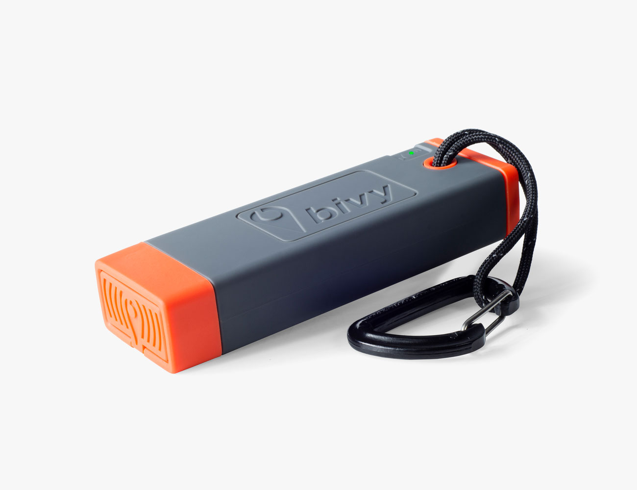
Best for: Affordable satellite communication
Learning Curve: 4/10
As with every satellite device here save the Spot, Bivystick uses the Iridium network. We found it roughly mid-pack for finding and linking with satellites, taking as long as five minutes under cloudy skies on hemmed-in trails but far quicker in an open field. Luckily you’re not left to guess, because the entire interface is via the Bivy app on your smartphone, and there’s a useful signal strength indicator on the upper right of that app’s home screen.
Speaking of the app, it’s one of the better facets of the system, and navigation and use are dead simple. Want to download a custom map? Tap the button with the three lines in the upper right-hand corner of the home screen and “Offline Maps” is one of the menu items. There you can see your maps, or download a new one, and you can navigate via the app to anywhere on the globe and zoom in or out to adjust the scale of the map you want to create; then tap download.
The Bivystick is relatively cheap, too. It costs $18/month, and there’s no signup charge or annual fee. Instead, the plan rolls over every month, and for that cost, you get ten credits. Every action, such as a text, a weather update and each two-hours of tracking at ten-minute intervals costs a credit. Unused credits roll over for up to 30 days, but even if you never re-up, every subsequent message is just $0.50, which equates to peace of mind at an affordable price. It’s big, but it does also function as an external charger for a phone, headlamp, etc.
One primary concern, however, is that unlike all the other devices that pair to a phone, the Bivystick lacks a dedicated SOS button, so you really must have a charged phone to call for help. A lesser annoyance, but a real one nonetheless, is that there’s no changing LED to indicate when your phone is paired, nor is there a noise to alert you when a text has gone through. That’s a minor beef, but a legit one. When you need to know you’ve been heard, but you’re perhaps otherwise engaged in, oh, saving your hide, a simple beep can alleviate some fear.
Membership: Monthly
Map Sharing: Yes
Weight: 7 ounces
Dimensions: 1 5/8 x 5 5/8 x 1 1/8 inches
Durability: Submersible in 1 meter of water up to 30 minutes
SOS Button: No
Battery Life: Rechargeable; in tethered/standby mode sending tracking at 10-minute intervals: 400 hours
Somewear
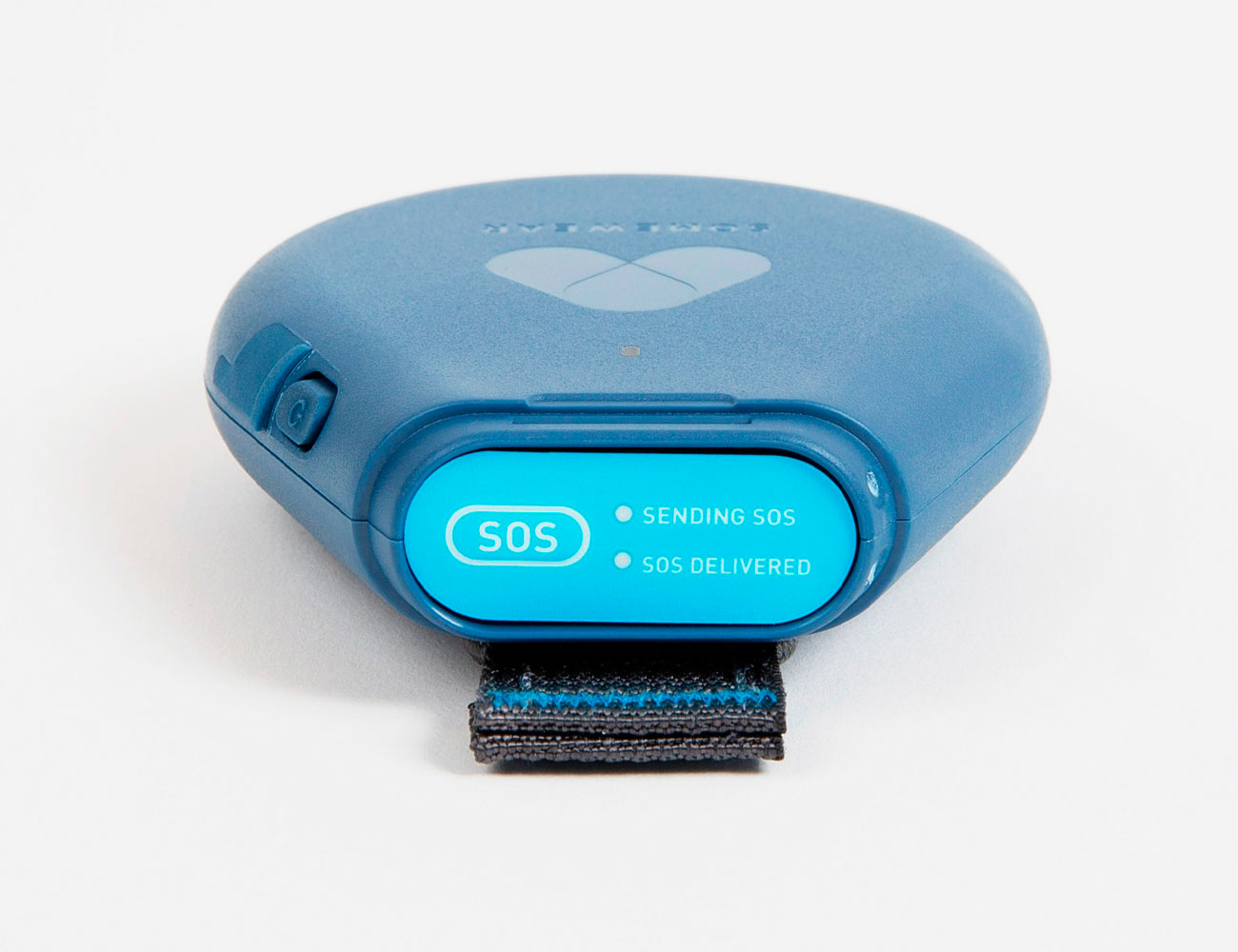
Best for: Affordable satellite communication
Learning Curve: 4/10
The Somewear unit is smaller and lighter than the Bivystick but is very similar in function. You use your phone, not the Somewear itself, for almost every function. There’s one exception: at the top there’s a removable cap with an SOS button underneath. Hold the button for six seconds to get search and rescue on its way. This is a significant advantage over the Bivystick, which has no physical way to put out an SOS — you have to use a paired phone for that. However, the cover on the Somewear SOS isn’t hinged, so it can pop off and potentially get lost at the bottom of your pack, or tumble into the dirt while you’re mountain biking. Sure, you have to hold the button beneath that lid for a solid six seconds so a hinged lid might get in the way, but still, this is a design flaw.
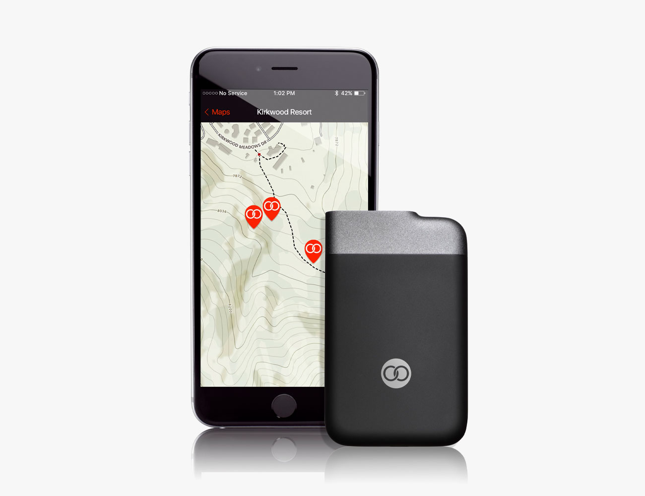
Beyond that, however, the Somewear is smart. The app is easy to use, and seeing satellite signal strength from the Iridium network is indicated clearly on the app home screen. The thread history of messages also looks exactly like it does on any cell phone, and access to your contacts (should you accede permission to the app) makes adding new messages easy. But know that they’ll see the message as coming from a different phone number and to reply they’ll be asked to create a Somewear account, but as with joining Garmin, that also means that messages from you will be duplicated to their email account as well as bounce in as an SMS. Additionally, Somewear recently enabled automated location pings as frequently as once per minute (over the course of an hour).
One thing we really like: Somewear has the most straightforward method for sending your location to a recipient. There’s a small “map pin” icon adjacent to the text input window. Tap it, and you send your GPS location. It couldn’t be easier.
Lows? While you can download offline maps, you can’t create a waypoint track to follow. Yes, you can enable live tracking, but that’s different from being able to download a trail that already exists and follow the breadcrumbs. It also cannot double as a backup phone battery, though it is considerably smaller and lighter than the Bivystick.
Like the Bivystick, Somewear is affordable once you’re in the club. There’s no activation fee and you get 20 messages or 150 location pin drops a month for $15/month. But note that you have to actively pause a monthly plan to keep it from rolling over, and unlike the Bivystick, a plan has to be in place to get the Somewear to work; no ad-hoc 50-cent-a-message plan exists for the Somewear.
Membership: Monthly or annual
Map Sharing: Yes
Weight: 4.2 ounces
Dimensions: 3 x 3.6 x 0.8 inches
Durability: Submersible in 1 meter of water up to 30 minutes
SOS Button: Yes
Battery Life: Rechargeable; in tethered/standby mode sending tracking at 30-minute intervals, 264 hours
GoTenna Mesh
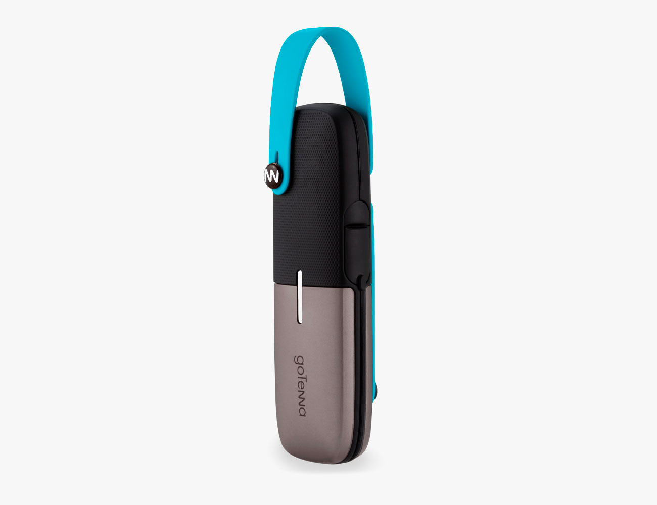
Best for: Saving on cell phone roaming charges; keeping a big group connected.
Learning Curve: 3/10
While Somewear makes it super simple to share your location, the menu structure of the GoTenna Mesh app tells you it’s designed for keeping a spread-out group consistently aware of each others’ coordinates. Why does this matter? Say you have a big crew of twenty folks on a Via Ferrata trip in Italy’s Dolomites; the fast group strikes out ahead, and the slow group trails. If there’s a GoTenna in each group, the two leaders of each party can stay in touch and send requests like “Location Sharing Auto-Share,” so every message between each party would include a pin drop and mapped location, or “Attach My Location,” to volunteer that information. Or “Location Requests Auto Accept,” which would ensure anyone in your party would be able to find your location just by sending you a message.
Yes, that does mean the GoTenna supports offline mapping, and you can download these maps easily within the app. GoTenna, however, isn’t a satellite communicator. It’s more like a walkie-talkie, using radio signaling to bounce between two or more GoTenna devices. Use the GoTenna app on your phone paired to the GoTenna to send and receive messages. Unlike the Beartooth device, dozens of GoTennas spread out work like the repeaters of cell phone towers or Wi-Fi area networks, strengthening the entire network.
The downside is range. Any single GoTenna is a weaker tether than the Beartooth, with a maximum reach of about four miles between two fixed points in an open area. Still, connectivity is consistently solid. In the densest forest, we could still text over about a half mile of range, and much greater range than that in the open, especially when one part of the party could go higher. And we really like the GoTenna phone interface that shows text delivery confirmation.
Spend another $10/year and GoTenna Plus provides more granular topo maps and the ability to group chat with up to six people at once. It also adds constant, automatic location pings as frequently as once a minute, and the ability to harness a cell network as a last-mile connection. Meaning: GoTenna User A, in the woods and beyond cell service could use GoTenna User B’s cell connection to hopscotch an SMS to non-GoTenna user, C, somewhere back in civilization.
Membership: Optional annual
Map Sharing: Yes
Weight: 1.7 ounces
Dimensions: 5 x 1.25 x 0.5 inches
Durability: Dust, water resistant
SOS Button: No
Battery Life: 27 hours in standby
Beartooth
Best for: Having a backcountry walkie-talkie via your smartphone
Learning Curve: 4/10
Beartooth devices are different than GoTenna in one fundamental way — they’re not designed on a mesh network principle. Instead, they’re best thought of as walkie-talkies, with each Beartooth paired to a phone, enabling that phone’s user to talk directly to another Beartooth user, or to several. Right: not just text but voice. But this isn’t a phone replacement; you don’t have a conversation so much as the ability to tap a virtual button on the Beartooth app, pause a half second, then speak; once you release the button, the app sends a voice recording. (It’s a lot like sending a voice message over SMS from a phone or Apple Watch.) If you’re standing above a couloir on a sketchy belay, being able to talk is a definite plus, even if the sound of these recordings is about as scratchy as noise from a ridiculously battered turntable playing haggard used-record store hits from the mid-70s. Who cares? It’s voice, it’s immediate, and it beats having to thumb type.
The other key asset Beartooth offers is a greater range — up to ten miles for a text in direct line of sight. While we didn’t try that full distance, we did see that Beartooth has a longer range than GoTenna.
Like GoTenna, Beartooth also lets you share location information, though there’s no upgraded map service like GoTenna Plus, so the maps are still relatively basic. And there’s no tracking function or bread crumb service to ping recipients automatically like GoTenna. And, Beartooth is more expensive.
On the upside, Beartooth has far longer battery life, and the ability to function as a battery backup for your cell phone, so it’s a better tool for extended forays into the wilderness, especially if your group is relatively small or likely to spread out.
Membership: None
Map Sharing: Yes
Weight: 4.5 ounces
Dimensions: 2.44 x 4 x 0.49 inches
Durability: Dust, water resistant
SOS Button: No
Battery Life: 4 days in standby

Unlike concrete sidewalks and gravel paths, the trail calls for hardened and supportive footwear to combat dirt, mud, jagged rocks and streams. The answer is hiking boots and hiking shoes, and these are the best available. Read the Story